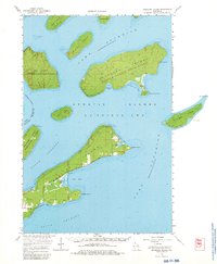
1964 Map of Madeline Island
USGS Topo · Published 1980About this map
Madeline Island and the surrounding Apostle Islands archipelago are detailed in this 1960s study, showcasing the maritime landscape of Lake Superior just as the Apostle Islands State Forest boundaries were established. The map highlights the coastal geography of Stockton Island, including Quarry Bay and Presque Isle Bay, as well as the elongated form of Michigan Island to the east.
Find a feature on this map
38 named features on this map. Tap any name to fly to it.
Don’t see what you’re looking for? This feature index may not catch every label — zoom into the map to look around manually.
Map Details
Editions of this 1964 Madeline Island Map
2 editions found
Other maps of this area

1941 · Bayfield
USGS Topo · 1:48,000

1942 · Ashland
USGS Topo · 1:48,000

1943 · Little Girl Point
USGS Topo · 1:48,000

1943 · Odanah
USGS Topo · 1:48,000

1945 · Odanah
USGS Topo · 1:48,000

1946 · Bayfield
USGS Topo · 1:48,000

1947 · Ashland
USGS Topo · 1:48,000

1953 · Ashland
USGS Topo · 1:250,000

1954 · Two Harbors
USGS Topo · 1:250,000
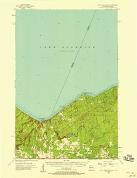
1956 · Little Girls Point
USGS Topo · 1:62,500