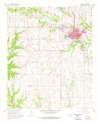
1963 Map of Madill
USGS Topo · Published 1978About this map
The Courthouse in Madill stands as the focal point of Marshall County in this mid-century survey, which reveals a landscape where rail transport and local industry converge. The St Louis - San Francisco railroad cuts through the terrain, passing near the Oakland-Madill Cem and the neighboring settlement of Oakland. Significant infrastructure includes the Waterworks and Sewage Disposal near Glasses Creek, along with a local Landing Strip and the Radio Tower (KMAD).
Find a feature on this map
33 named features on this map. Tap any name to fly to it.
Don’t see what you’re looking for? This feature index may not catch every label — zoom into the map to look around manually.
Map Details
Editions of this 1963 Madill Map
2 editions found
Other maps of this area

1901 · Tishomingo
USGS Topo · 1:125,000

1901 · Denison
USGS Topo · 1:125,000

1954 · Sherman
USGS Topo · 1:250,000

1957 · Ardmore
USGS Topo · 1:250,000

1958 · Gordonville
USGS Topo · 1:62,500

1958 · Denison Dam
USGS Topo · 1:62,500

1958 · Sherman
USGS Topo · 1:250,000

1963 · Ardmore
USGS Topo · 1:250,000

1963 · Madill
USGS Topo · 1:24,000

1963 · Mannsville
USGS Topo · 1:24,000