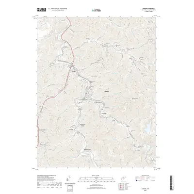
2019 Map of Madison
USGS Topo · Published 2019About this map
The Boone County Courthouse serves as the focal point for the riverside communities of Madison and Danville along the winding banks of the Little Coal River. This 2019 survey documents a landscape defined by steep Appalachian topography, where development follows the narrow corridors carved by the Pond Fork and Spruce Fork as they converge. Numerous family cemeteries, including Riley Hill Cem, Echols Cem, and Vandelinde Cem, are situated on the hillsides above the valley floor, providing a detailed record for genealogists researching Boone County lineages. The transition from historical river-based transport to modern infrastructure is marked by several named spans, such as the LT Darwin K Kyle Memorial Bridge and the Benjamin Price Bridge. To the south and east, the terrain rises sharply toward Workman Knob, with smaller settlements like Uneeda, Quinland, and Foch established at the base of the ridges.
Find a feature on this map
125 named features on this map. Tap any name to fly to it.
Don’t see what you’re looking for? This feature index may not catch every label — zoom into the map to look around manually.
Map Details
Editions of this 2019 Madison Map
This is the sole edition of this map. No revisions or reprints were ever made.
Other maps of this area

1891 · Oceana
USGS Topo · 1:125,000

1893 · Oceana
USGS Topo · 1:125,000

1898 · Oceana
USGS Topo · 1:125,000

1899 · Charleston
USGS Topo · 1:125,000

1909 · Peytona
USGS Topo · 1:48,000

1910 · Bald Knob
USGS Topo · 1:48,000

1911 · Peytona
USGS Topo · 1:62,500

1911 · Madison
USGS Topo · 1:62,500

1912 · Bald Knob
USGS Topo · 1:62,500

1913 · Logan
USGS Topo · 1:62,500