2023 Map of Madison
USGS Topo · Published 2023About this map
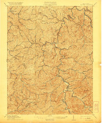
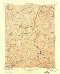
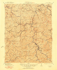
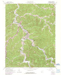
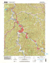
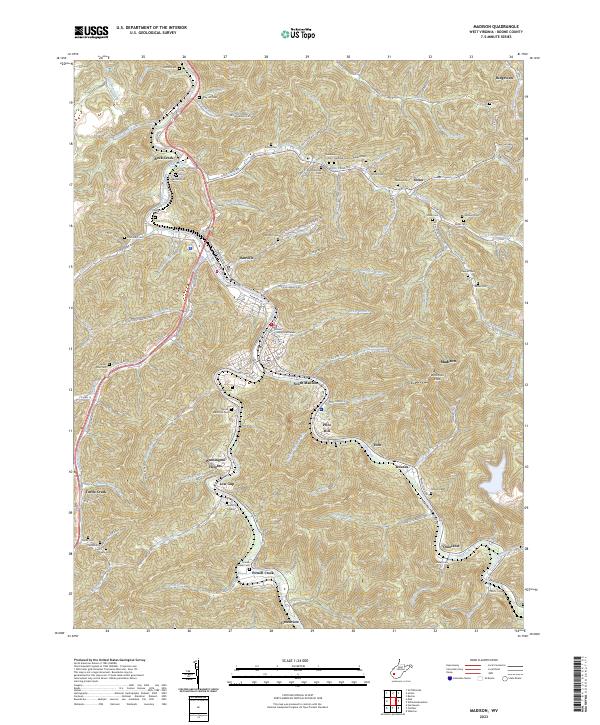
The Little Coal River and Pond Fork define the settlement patterns of central Boone County, where the city of Madison serves as a focal point for the surrounding hollows. Near the Boone County Courthouse, the terrain transitions into the steep ridges of Workman Knob and Price Hill. This 2023 survey documents a landscape where family history is deeply rooted in numerous small burial grounds, including the Riley Hill Cem, Halstead Cem, and multiple locations of the Miller Cem. The geography of the region is shaped by a dense network of named watercourses like Sulphur Spring Branch and Slippery Gut Branch, which dictate the placement of communities such as Danville, South Madison, and Washington Heights. Infrastructure such as Memory Gardens and Boone Memorial Park reflect the area's established civic identity amidst the winding roads of the West Virginia coalfields.
Find a feature on this map
134 named features on this map. Tap any name to fly to it.
Don’t see what you’re looking for? This feature index may not catch every label — zoom into the map to look around manually.
Map Details
Editions of this 2023 Madison Map
This is the sole edition of this map. No revisions or reprints were ever made.
Historical Maps of Van Camp Through Time
6 maps found