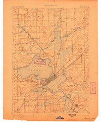
1892 Map of Madison
USGS Topo · Published 1898About this map
The Isthmus of Madison is the central focus of this late 19th-century topographic record, showing the city's early development between Lake Mendota and Lake Monona. Surveyed by J.H. Renshawe and I.M. Buell, the landscape is defined by the glacial geography of the Four Lakes region, with the southern waters of Lake Wingra and Lake Waubesa providing a clear view of the surrounding drainage through Catfish Creek.
Find a feature on this map
30 named features on this map. Tap any name to fly to it.
Don’t see what you’re looking for? This feature index may not catch every label — zoom into the map to look around manually.
Map Details
Editions of this 1892 Madison Map
3 editions found
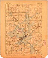
Other maps of this area

1889 · Evansville
USGS Topo · 1:62,500

1890 · Madison
USGS Topo · 1:62,500

1890 · Sun Prairie
USGS Topo · 1:62,500

1890 · Stoughton
USGS Topo · 1:62,500

1892 · Madison
USGS Topo · 1:62,500

1894 · Evansville
USGS Topo · 1:62,500

1895 · Baraboo
USGS Topo · 1:62,500

1896 · Sun Prairie
USGS Topo · 1:62,500

1901 · Poynette
USGS Topo · 1:62,500

1904 · Madison
USGS Topo · 1:62,500