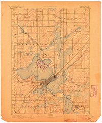
1892 Map of Madison
USGS Topo · Published 1903About this map
Madison is established as a vital transportation and topographic center on the isthmus between Lake Mendota and Lake Monona in this late nineteenth-century reconnaissance. The early grid of the state capital is bounded by an extensive network of iron rails, including the Chicago Milwaukee and St Paul Railroad and the Chicago and Northwestern Railroad, which converge near the city center. This industrial era connectivity defines the surrounding landscape of Dane County, reaching out to satellite settlements like Waunakee, De Forest, and Mac Farland.
Find a feature on this map
32 named features on this map. Tap any name to fly to it.
Don’t see what you’re looking for? This feature index may not catch every label — zoom into the map to look around manually.
Map Details
Editions of this 1892 Madison Map
3 editions found
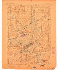
Other maps of this area

1889 · Evansville
USGS Topo · 1:62,500

1890 · Madison
USGS Topo · 1:62,500

1890 · Sun Prairie
USGS Topo · 1:62,500

1890 · Stoughton
USGS Topo · 1:62,500

1892 · Madison
USGS Topo · 1:62,500

1894 · Evansville
USGS Topo · 1:62,500

1895 · Baraboo
USGS Topo · 1:62,500

1896 · Sun Prairie
USGS Topo · 1:62,500

1901 · Poynette
USGS Topo · 1:62,500

1904 · Madison
USGS Topo · 1:62,500