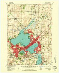
1959 Map of Madison
USGS Topo · Published 1961About this map
The Isthmus between Lake Mendota and Lake Monona anchors this detailed look at Madison and its surrounding townships during a period of significant post-war expansion. The State Capitol and the sprawling University of Wisconsin campus serve as the urban core, while the University of Wisconsin Arboretum preserves green space along the shores of Lake Wingra. Surrounding the city, the landscape is dotted with rural identifiers of a passing era, from the Pumpkin Hollow Sch and Sanderson Sch to family-named burial grounds like the Matson Cem.
Find a feature on this map
108 named features on this map. Tap any name to fly to it.
Don’t see what you’re looking for? This feature index may not catch every label — zoom into the map to look around manually.
Map Details
Editions of this 1959 Madison Map
3 editions found

Other maps of this area

1889 · Evansville
USGS Topo · 1:62,500

1890 · Madison
USGS Topo · 1:62,500

1890 · Sun Prairie
USGS Topo · 1:62,500

1890 · Stoughton
USGS Topo · 1:62,500

1892 · Madison
USGS Topo · 1:62,500

1894 · Evansville
USGS Topo · 1:62,500

1895 · Baraboo
USGS Topo · 1:62,500

1896 · Sun Prairie
USGS Topo · 1:62,500

1901 · Poynette
USGS Topo · 1:62,500

1904 · Madison
USGS Topo · 1:62,500