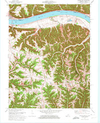
1971 Map of Madison East
USGS Topo · Published 1973About this map
The Ohio River forms a sharp geographic and political boundary here, separating the riverfront city of Madison, Indiana, from the Kentucky hillsides of Milton. In the early 1970s, this landscape is defined by its dramatic relief, with the Big Cedar Cliffs and Hampton Hollow framing the river valley while a network of high ridges like Fairview Ridge and Freeport Ridge dominate the Kentucky interior.
Find a feature on this map
28 named features on this map. Tap any name to fly to it.
Don’t see what you’re looking for? This feature index may not catch every label — zoom into the map to look around manually.
Map Details
Editions of this 1971 Madison East Map
4 editions found
Other maps of this area

1939 · Bethlehem
USGS Topo · 1:24,000

1939 · Madison West
USGS Topo · 1:24,000

1943 · Brooksburg
USGS Topo · 1:24,000

1948 · Bethlehem
USGS Topo · 1:24,000

1948 · Madison West
USGS Topo · 1:24,000

1952 · Campbellsburg
USGS Topo · 1:24,000

1953 · Madison West
USGS Topo · 1:24,000

1953 · Bedford
USGS Topo · 1:24,000

1953 · Carrollton
USGS Topo · 1:24,000

1953 · Madison East
USGS Topo · 1:24,000