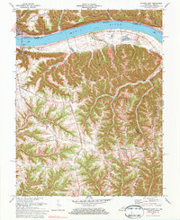
1971 Map of Madison East
USGS Topo · Published 1984About this map
The Ohio River forms a wide natural boundary between Madison, Indiana, and the town of Milton in Kentucky during this early 1970s survey. The landscape is characterized by a series of prominent ridges, such as Leeport Ridge, Kings Ridge, and Hampton Ridge, which dictated the early settlement and road patterns of the region. Many small communities and family-centered landmarks are scattered across these heights, including Fairview and the crossroads at Monitor.
Find a feature on this map
55 named features on this map. Tap any name to fly to it.
Don’t see what you’re looking for? This feature index may not catch every label — zoom into the map to look around manually.
Map Details
Editions of this 1971 Madison East Map
4 editions found
Other maps of this area

1939 · Bethlehem
USGS Topo · 1:24,000

1939 · Madison West
USGS Topo · 1:24,000

1943 · Brooksburg
USGS Topo · 1:24,000

1948 · Bethlehem
USGS Topo · 1:24,000

1948 · Madison West
USGS Topo · 1:24,000

1952 · Campbellsburg
USGS Topo · 1:24,000

1953 · Madison West
USGS Topo · 1:24,000

1953 · Bedford
USGS Topo · 1:24,000

1953 · Carrollton
USGS Topo · 1:24,000

1953 · Madison East
USGS Topo · 1:24,000