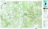
1990 Map of Madison
USGS Topo · Published 1991About this map
The Ohio River carves a deep valley through this landscape, serving as the primary geographic and political boundary between Indiana and Kentucky. Along its northern banks, the massive Jefferson Proving Ground dominates the interior of Jefferson Co, while Clifty Falls State Park preserves the sharp elevation drops typical of the region's river bluffs. To the west, the transportation corridor defined by I-65 and the P C RR links important regional hubs such as Seymour, Austin, and Scottsburg.
Find a feature on this map
174 named features on this map. Tap any name to fly to it.
Don’t see what you’re looking for? This feature index may not catch every label — zoom into the map to look around manually.
Map Details
Editions of this 1990 Madison Map
This is the sole edition of this map. No revisions or reprints were ever made.
Other maps of this area

1905 · Prospect
USGS Topo · 1:62,500

1906 · Lockport
USGS Topo · 1:48,000

1908 · Lockport
USGS Topo · 1:62,500

1912 · Prospect
USGS Topo · 1:62,500

1915 · Lawrenceburg
USGS Topo · 1:48,000

1928 · New Castle
USGS Topo · 1:48,000

1928 · Lawrenceburg
USGS Topo · 1:62,500

1932 · New Castle
USGS Topo · 1:62,500

1932 · Lawrenceburg
USGS Topo · 1:62,500

1932 · La Grange
USGS Topo · 1:62,500