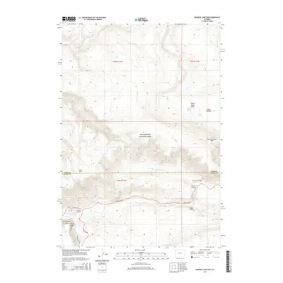
2015 Map of Madison Junction
USGS Topo · Published 2015About this map
The confluence of the Gibbon River and the Firehole River at Madison Junction serves as the central focal point for this section of Yellowstone National Park. This 2015 survey documents the complex hydrothermal geography of the region, featuring numerous thermal landmarks such as Gibbon Geyser Basin, Evening Primrose Spring, and the Monument Geyser Basin. The landscape is defined by its dramatic geological transitions, where the river systems cut through Gibbon Canyon and Firehole Canyon, the latter featuring Firehole Falls.
Find a feature on this map
29 named features on this map. Tap any name to fly to it.
Don’t see what you’re looking for? This feature index may not catch every label — zoom into the map to look around manually.
Map Details
Editions of this 2015 Madison Junction Map
This is the sole edition of this map. No revisions or reprints were ever made.
Other maps of this area

1885 · Gallatin
USGS Topo · 1:125,000

1885 · Gallatin
USGS Topo · 1:125,000

1901 · Gallatin
USGS Topo · 1:125,000

1908 · Gallatin
USGS Topo · 1:125,000

1911 · Gallatin
USGS Topo · 1:125,000

1955 · Ashton
USGS Topo · 1:250,000

1958 · Ashton
USGS Topo · 1:250,000

1958 · Madison Junction
USGS Topo · 1:62,500

1958 · Mount Holmes
USGS Topo · 1:62,500
1958 · Norris Junction
USGS Topo · 1:62,500