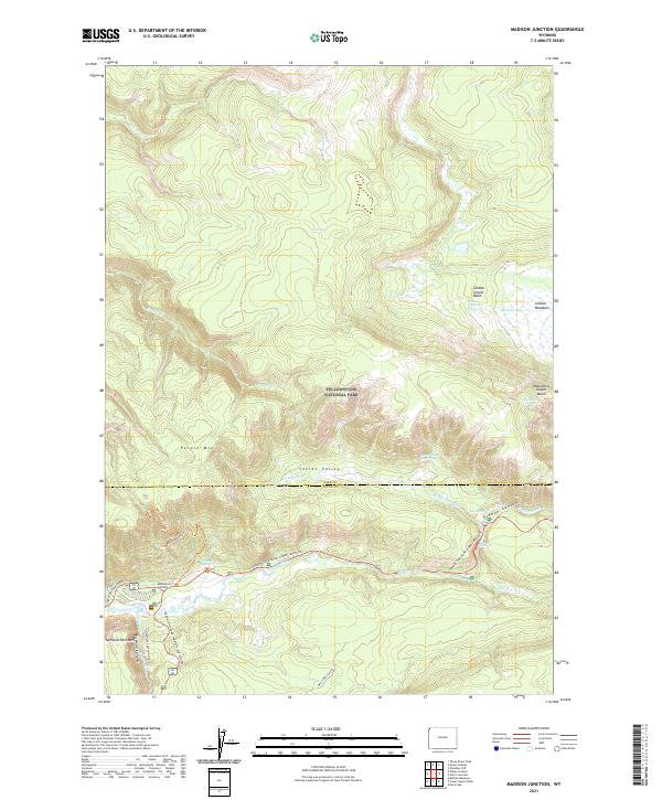
2021 Map of Madison Junction
USGS Topo · Published 2021About this map
Madison Junction serves as the focal point where the Gibbon River and Firehole River converge to form the Madison River in this modern survey of Yellowstone National Park. The landscape is defined by its hydrothermal activity, showcasing the Gibbon Geyser Basin and the higher-elevation Monument Geyser Basin. Notable features like Jet Geyser, Sylvan Spring, and Secret Valley Hot Springs illustrate the complex geothermal plumbing of the region.
Find a feature on this map
37 named features on this map. Tap any name to fly to it.
Don’t see what you’re looking for? This feature index may not catch every label — zoom into the map to look around manually.
Map Details
Editions of this 2021 Madison Junction Map
This is the sole edition of this map. No revisions or reprints were ever made.
Other maps of this area

1885 · Gallatin
USGS Topo · 1:125,000

1885 · Gallatin
USGS Topo · 1:125,000

1901 · Gallatin
USGS Topo · 1:125,000

1908 · Gallatin
USGS Topo · 1:125,000

1911 · Gallatin
USGS Topo · 1:125,000

1955 · Ashton
USGS Topo · 1:250,000

1958 · Ashton
USGS Topo · 1:250,000

1958 · Madison Junction
USGS Topo · 1:62,500

1958 · Mount Holmes
USGS Topo · 1:62,500
1958 · Norris Junction
USGS Topo · 1:62,500