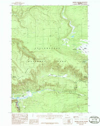
1986 Map of Madison Junction
USGS Topo · Published 1986About this map
The convergence of the Gibbon River and Firehole River forms the Madison River at the historic Madison Junction, a central hub for early park travel. This 1980s-era survey details the complex thermal landscape of Yellowstone National Park, featuring the Gibbon Geyser Basin, Monument Geyser Basin, and numerous specific thermal features like Evening Primrose Spring and Sylvan Springs. The topography is dominated by Purple Mountain and National Park Mountain, which overlook the developed recreational facilities including a Campground, Amphitheater, and Picnic Area. The map also traces the Trans Line through the dense terrain and captures the descent of the river at Gibbon Falls, providing a precise record of the geological and administrative landscape along the Park and Teton County boundary before modern infrastructure expansions.
Find a feature on this map
26 named features on this map. Tap any name to fly to it.
Don’t see what you’re looking for? This feature index may not catch every label — zoom into the map to look around manually.
Map Details
Editions of this 1986 Madison Junction Map
This is the sole edition of this map. No revisions or reprints were ever made.
Other maps of this area

1885 · Gallatin
USGS Topo · 1:125,000

1885 · Gallatin
USGS Topo · 1:125,000

1901 · Gallatin
USGS Topo · 1:125,000

1908 · Gallatin
USGS Topo · 1:125,000

1911 · Gallatin
USGS Topo · 1:125,000

1955 · Ashton
USGS Topo · 1:250,000

1958 · Ashton
USGS Topo · 1:250,000

1958 · Madison Junction
USGS Topo · 1:62,500

1958 · Mount Holmes
USGS Topo · 1:62,500
1958 · Norris Junction
USGS Topo · 1:62,500