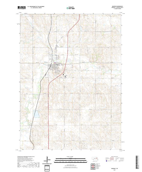
2021 Map of Madison
USGS Topo · Published 2021About this map
The Madison County Courthouse stands at the heart of the seat of Madison, marking a point of transition between the dense residential grid and the surrounding agricultural sections of northeastern Nebraska. This map illustrates a town structured around its civic core, with the Po and historic religious landmarks like Saint Leonards Ch defining the community center. To the south of the main streets, Saint Leonards Cem and Crown Hill Cem serve as vital records of the local population and heritage.
Find a feature on this map
53 named features on this map. Tap any name to fly to it.
Don’t see what you’re looking for? This feature index may not catch every label — zoom into the map to look around manually.
Map Details
Editions of this 2021 Madison Map
This is the sole edition of this map. No revisions or reprints were ever made.
Other maps of this area

1955 · Fremont
USGS Topo · 1:250,000

1957 · Fremont
USGS Topo · 1:250,000

1958 · Fremont
USGS Topo · 1:250,000

1963 · Madison
USGS Topo · 1:24,000

1963 · Madison SE
USGS Topo · 1:24,000

1963 · Battle Creek
USGS Topo · 1:24,000
1963 · Madison NE
USGS Topo · 1:24,000
1963 · Enola
USGS Topo · 1:24,000

1963 · Battle Creek SE
USGS Topo · 1:24,000

1966 · Creston
USGS Topo · 1:24,000