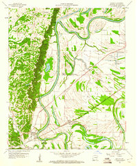
1960 Map of Madison
USGS Topo · Published 1960About this map
Crowleys Ridge dominates the western landscape of this St. Francis County region, providing a sharp topographical contrast to the winding St Francis River bottomlands. The 1960 landscape is defined by the interaction between these elevated woodlands and the flood-prone basins containing numerous oxbows like Horseshoe Lake and Beaty Lake. This era shows a community rooted in the land, with numerous country churches such as New Sardis Ch and Oak Grove Ch serving as local anchors.
Find a feature on this map
41 named features on this map. Tap any name to fly to it.
Don’t see what you’re looking for? This feature index may not catch every label — zoom into the map to look around manually.
Map Details
Editions of this 1960 Madison Map
3 editions found
Other maps of this area

1939 · Park Place
USGS Topo · 1:62,500

1939 · Wynne
USGS Topo · 1:62,500

1940 · Whitmore
USGS Topo · 1:62,500

1940 · Marianna
USGS Topo · 1:62,500

1948 · Helena
USGS Topo · 1:250,000

1950 · Helena
USGS Topo · 1:250,000

1953 · Memphis
USGS Topo · 1:250,000

1955 · Park Place
USGS Topo · 1:62,500

1955 · Helena
USGS Topo · 1:250,000

1956 · Memphis
USGS Topo · 1:250,000