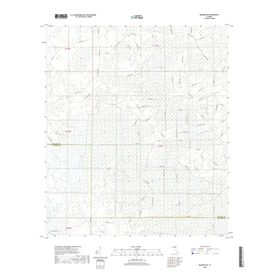
2018 Map of Madison SW
USGS Topo · Published 2018About this map
San Pedro Bay dominates this portion of the Florida Panhandle, characterized by an extensive network of wetlands and drainage basins. The landscape is defined by the boundary between Madison Co and Taylor Co, where the terrain is largely undeveloped and serves primarily as timberland or conservation area. A complex grid of rural roads and fire breaks, such as Sw San Pedro Rd and Sw Tower Rd, provides the only structured access through the dense bay and swamp environments. This 2018 survey reveals the persistent wildness of the region, where naming conventions often follow utilitarian paths like Sw Wire Rd or land management routes. The lack of traditional town centers highlights the area's role as a vast hydrological filter, with small water bodies like those near Sw Hike Lake Rd and Sw Clear Lake Rd peppered throughout the low-lying reaches.
Find a feature on this map
74 named features on this map. Tap any name to fly to it.
Don’t see what you’re looking for? This feature index may not catch every label — zoom into the map to look around manually.
Map Details
Editions of this 2018 Madison SW Map
This is the sole edition of this map. No revisions or reprints were ever made.
Other maps of this area

1954 · Day
USGS Topo · 1:24,000

1954 · Boyd
USGS Topo · 1:24,000

1954 · Day NW
USGS Topo · 1:24,000

1954 · Greenville NE
USGS Topo · 1:24,000

1954 · Valdosta
USGS Topo · 1:250,000

1955 · Greenville SE
USGS Topo · 1:24,000

1958 · Valdosta
USGS Topo · 1:250,000

1958 · Madison SW
USGS Topo · 1:24,000

1958 · Madison SE
USGS Topo · 1:24,000

1958 · Lee
USGS Topo · 1:24,000