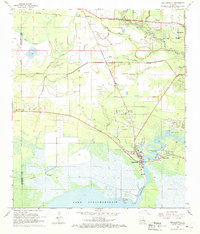
1968 Map of Madisonville
USGS Topo · Published 1969About this map
The Tchefuncta River winds southward through St. Tammany Parish, defining the landscape as it approaches its mouth at Lake Pontchartrain. Along its banks, the community of Madisonville serves as a focal point, flanked by the residential growth of Houltonville and the protected grounds of Fairview Riverside State Park. The map reveals a high density of small family and community burial grounds, such as Daussin Cem, Galatas Cem, and Dendinger Cem, which provide significant value for genealogical research in this coastal area.
Find a feature on this map
43 named features on this map. Tap any name to fly to it.
Don’t see what you’re looking for? This feature index may not catch every label — zoom into the map to look around manually.
Map Details
Editions of this 1968 Madisonville Map
4 editions found
Other maps of this area

1935 · Covington
USGS Topo · 1:62,500

1935 · Ponchatoula
USGS Topo · 1:62,500

1939 · Ponchatoula
USGS Topo · 1:62,500

1939 · Covington
USGS Topo · 1:62,500

1942 · Onville
USGS Topo · 1:31,680

1942 · Waldheim
USGS Topo · 1:31,680

1942 · Robert
USGS Topo · 1:31,680

1950 · Covington
USGS Topo · 1:62,500

1951 · Ponchatoula
USGS Topo · 1:62,500

1954 · Folsom
USGS Topo · 1:62,500