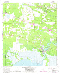
1968 Map of Madisonville
USGS Topo · Published 1980About this map
The Tchefuncta River winds toward its mouth at Lake Pontchartrain, anchoring the historic settlement of Madisonville. This survey, updated in the late 1970s, illustrates the complex hydrology of the Louisiana shoreline where Blue Swamp Creek and Bayou De Zaire feed into the river's lower reaches. The landscape is a mix of lowland marsh and rising piney woods, featuring several small communities and family-named landmarks.
Find a feature on this map
39 named features on this map. Tap any name to fly to it.
Don’t see what you’re looking for? This feature index may not catch every label — zoom into the map to look around manually.
Map Details
Editions of this 1968 Madisonville Map
4 editions found
Other maps of this area

1935 · Covington
USGS Topo · 1:62,500

1935 · Ponchatoula
USGS Topo · 1:62,500

1939 · Ponchatoula
USGS Topo · 1:62,500

1939 · Covington
USGS Topo · 1:62,500

1942 · Onville
USGS Topo · 1:31,680

1942 · Waldheim
USGS Topo · 1:31,680

1942 · Robert
USGS Topo · 1:31,680

1950 · Covington
USGS Topo · 1:62,500

1951 · Ponchatoula
USGS Topo · 1:62,500

1954 · Folsom
USGS Topo · 1:62,500