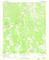
1965 Map of Madras
USGS Topo · Published 1972About this map
Madras and the surrounding Coweta County countryside are defined by a network of rural settlements and family-named lakes in the mid-1960s. The Atlanta and West Point railroad cuts through the terrain, anchoring communities like McCollum and Thomas Crossroads. Local life centers around a high concentration of country churches, including Morning Star Ch, New Mt Calvary Ch, and St Johns Ch, many of which are accompanied by small cemeteries.
Find a feature on this map
68 named features on this map. Tap any name to fly to it.
Don’t see what you’re looking for? This feature index may not catch every label — zoom into the map to look around manually.
Map Details
Editions of this 1965 Madras Map
4 editions found

Other maps of this area

1891 · Marietta
USGS Topo · 1:125,000

1895 · Marietta
USGS Topo · 1:125,000

1897 · Marietta
USGS Topo · 1:125,000

1901 · Marietta
USGS Topo · 1:125,000

1953 · Atlanta
USGS Topo · 1:250,000

1954 · Palmetto
USGS Topo · 1:24,000

1954 · Fairburn
USGS Topo · 1:24,000

1957 · Atlanta
USGS Topo · 1:250,000

1958 · Rico
USGS Topo · 1:24,000

1958 · Atlanta
USGS Topo · 1:250,000