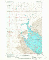
1956 Map of Mae
USGS Topo · Published 1967About this map
Hiawatha Valley and the expansive waters of Potholes Reservoir define this mid-1950s landscape in Grant County. The map documents a pivotal moment for the region’s water management, recording the reservoir at an elevation of 1039 feet in June 1956. This man-made water body significantly altered the local geography, inundating the complex topography of The Potholes where water now weaves through a labyrinth of semi-submerged Sand Dunes.
Find a feature on this map
12 named features on this map. Tap any name to fly to it.
Don’t see what you’re looking for? This feature index may not catch every label — zoom into the map to look around manually.
Map Details
Editions of this 1956 Mae Map

Other maps of this area

1910 · Winchester
USGS Topo · 1:62,500

1911 · Red Rock
USGS Topo · 1:62,500

1912 · Moses Lake
USGS Topo · 1:62,500

1923 · Corfu
USGS Topo · 1:62,500

1950 · Smyrna
USGS Topo · 1:62,500

1951 · Smyrna
USGS Topo · 1:62,500

1951 · Corfu
USGS Topo · 1:62,500

1953 · Walla Walla
USGS Topo · 1:250,000

1953 · Ritzville
USGS Topo · 1:250,000

1956 · Moses Lake South
USGS Topo · 1:24,000