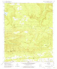
1966 Map of Magazine Mountain NE
USGS Topo · Published 1979About this map
Magazine Mountain dominates the southern landscape of this mid-1960s survey, marking a dramatic change in elevation where the Ozark National Forest meets the surrounding valleys. The terrain is defined by prominent peaks like Rich Mountain and Huckleberry Mountain, with deep valleys such as Bear Hollow carved out by Big Shoal Creek and its many tributaries. Settlement patterns are sparse, primarily concentrated in small communities like Waveland and Ferguson along the southern edge, where the Chicago Rock Island And Pacific railroad runs parallel to the hills.
Find a feature on this map
43 named features on this map. Tap any name to fly to it.
Don’t see what you’re looking for? This feature index may not catch every label — zoom into the map to look around manually.
Map Details
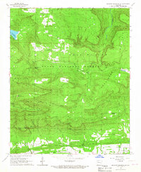
Editions of this 1966 Magazine Mountain NE Map
2 editions found
Other maps of this area

1879 · Mountain Home
USGS Topo · 1:62,500

1887 · Magazine Mountain #1
USGS Topo · 1:62,500

1887 · Magazine Mountain #4
USGS Topo · 1:62,500

1887 · Magazine Mountain
USGS Topo · 1:62,500

1888 · Dardanelle #2
USGS Topo · 1:62,500

1888 · Dardanelle #3
USGS Topo · 1:62,500

1890 · Magazine Mountain
USGS Topo · 1:125,000

1890 · Dardanelle
USGS Topo · 1:125,000

1956 · Russellville
USGS Topo · 1:250,000
1961 · Scranton
USGS Topo · 1:24,000