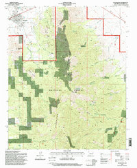
1995 Map of Magdalena
USGS Topo · Published 1998About this map
Magdalena and the nearby settlement of Kelly anchor this high-altitude landscape in the mid-1990s, where the western edge of the Magdalena Mountains meets the rolling high desert. The terrain is defined by extreme vertical relief, rising from the town center to prominent summits like Magdalena Peak and North Baldy. This area, largely contained within the Cibola National Forest, shows a complex history of resource extraction, with numerous mines, prospects, and tailings piles concentrated around the Kelly Gulch and Chihuahua Gulch drainages.
Find a feature on this map
49 named features on this map. Tap any name to fly to it.
Don’t see what you’re looking for? This feature index may not catch every label — zoom into the map to look around manually.
Map Details
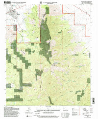
Editions of this 1995 Magdalena Map
2 editions found
Other maps of this area

1954 · Tularosa
USGS Topo · 1:250,000

1954 · Socorro
USGS Topo · 1:250,000

1958 · Socorro
USGS Topo · 1:250,000

1958 · Tularosa
USGS Topo · 1:250,000

1959 · Magdalena
USGS Topo · 1:62,500

1962 · Socorro
USGS Topo · 1:250,000

1963 · Arroyo Landavaso
USGS Topo · 1:24,000

1964 · Silver Hill
USGS Topo · 1:24,000
1965 · Squaw Peak
USGS Topo · 1:24,000
1965 · South Baldy
USGS Topo · 1:24,000