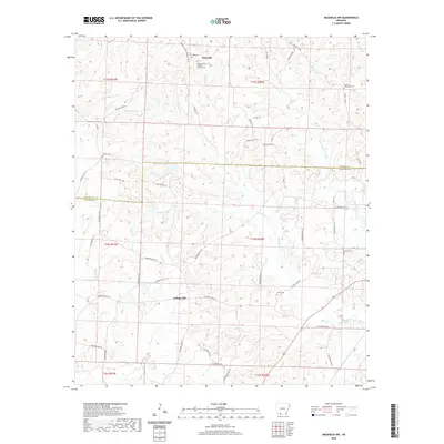
2020 Map of Magnolia NW
USGS Topo · Published 2020About this map
Glenville and College Hill anchor this rural landscape along the border of Nevada and Columbia Counties. The area is defined by a dense network of watercourses, including the winding paths of Smackover Cr, Big Cr, and Crooked Cr. For those researching family history, the map identifies several local burial grounds such as Bolden-Yarbrough Cem and the Mount Vernon Baptist Church Cem.
Find a feature on this map
64 named features on this map. Tap any name to fly to it.
Don’t see what you’re looking for? This feature index may not catch every label — zoom into the map to look around manually.
Map Details
Editions of this 2020 Magnolia NW Map
This is the sole edition of this map. No revisions or reprints were ever made.
Other maps of this area

1901 · Gurdon
USGS Topo · 1:125,000

1953 · El Dorado
USGS Topo · 1:250,000

1957 · El Dorado
USGS Topo · 1:250,000

1958 · El Dorado
USGS Topo · 1:250,000

1960 · El Dorado
USGS Topo · 1:250,000

1966 · Village
USGS Topo · 1:24,000

1968 · Lamartine
USGS Topo · 1:24,000

1968 · Waldo
USGS Topo · 1:24,000
1968 · Magnolia
USGS Topo · 1:24,000
1969 · Stephens
USGS Topo · 1:24,000