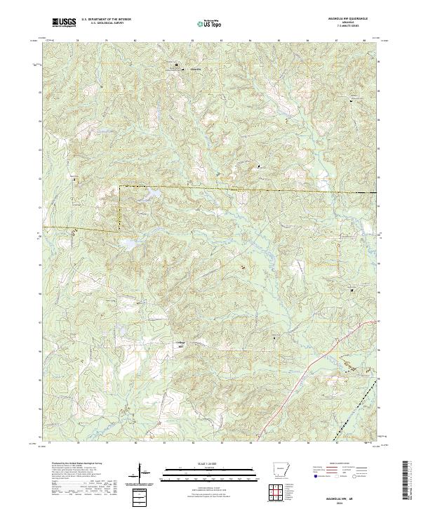
2024 Map of Magnolia NW
USGS Topo · Published 2024About this map
Glenville and College Hill anchor the landscape of northern Columbia County, where a network of rural roads connects scattered homesteads and local landmarks. This area is characterized by its numerous small burial grounds and spiritual centers, such as Mount Vernon Baptist Church-Cem and Tick Hill Cem, reflecting the deep-rooted family history of the region. The terrain is defined by the winding course of Smackover Creek and its many tributaries, including Blake Creek and Little Smackover Creek. These waterways, along with smaller bodies like Lake Bradshaw and Fincher Lake, suggest a land historically shaped by timber and small-scale agriculture. The boundary line between Nevada and Columbia counties cuts through the northern portion of the map, separating the northern settlement at Glenville from the southern rural reaches near College Hill.
Find a feature on this map
64 named features on this map. Tap any name to fly to it.
Don’t see what you’re looking for? This feature index may not catch every label — zoom into the map to look around manually.
Map Details
Editions of this 2024 Magnolia NW Map
This is the sole edition of this map. No revisions or reprints were ever made.
Other maps of this area

1901 · Gurdon
USGS Topo · 1:125,000

1953 · El Dorado
USGS Topo · 1:250,000

1957 · El Dorado
USGS Topo · 1:250,000

1958 · El Dorado
USGS Topo · 1:250,000

1960 · El Dorado
USGS Topo · 1:250,000

1966 · Village
USGS Topo · 1:24,000

1968 · Lamartine
USGS Topo · 1:24,000

1968 · Waldo
USGS Topo · 1:24,000
1968 · Magnolia
USGS Topo · 1:24,000
1969 · Stephens
USGS Topo · 1:24,000