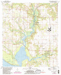
1980 Map of Magnolia Springs
USGS Topo · Published 1986About this map
Fish River and the Magnolia River converge toward Weeks Bay in this coastal Alabama survey, revealing a landscape defined by its waterways and small agrarian communities. The settlement of Magnolia Springs sits near the headwaters of its namesake river, while further north along the winding riverbanks, Marlow and Clay City appear as established rural nodes. A notable industrial marker is the Claypit near the northern border, suggesting the local brick-making heritage of the region.
Find a feature on this map
40 named features on this map. Tap any name to fly to it.
Don’t see what you’re looking for? This feature index may not catch every label — zoom into the map to look around manually.
Map Details
Editions of this 1980 Magnolia Springs Map
3 editions found
Other maps of this area

1920 · Robertsdale
USGS Topo · 1:62,500

1921 · Bon Secour
USGS Topo · 1:62,500

1921 · Point Clear
USGS Topo · 1:62,500

1921 · Fairhope
USGS Topo · 1:62,500

1939 · Daphne
USGS Topo · 1:31,680

1940 · Silverhill
USGS Topo · 1:31,680

1941 · Daphne
USGS Topo · 1:31,680

1941 · Silverhill
USGS Topo · 1:31,680

1941 · Robertsdale
USGS Topo · 1:62,500

1941 · Foley
USGS Topo · 1:62,500