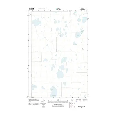
2010 Map of Mahnomen NE
USGS Topo · Published 2010About this map
Beaulieu Lake Dam controls the waters of the upper Marsh Creek watershed in this section of Polk County, where glacial geology has left a landscape saturated with small, named basins. The hydrography of the region is the defining characteristic, with bodies of water such as Little Vanose Lake, Allen Lake, and Aspinwall Lake dotting the terrain between a rigid grid of rural roads. This 2010 survey illustrates a sparsely populated agricultural and wetland environment where land use is dictated by the water table and drainage patterns.
Find a feature on this map
20 named features on this map. Tap any name to fly to it.
Don’t see what you’re looking for? This feature index may not catch every label — zoom into the map to look around manually.
Map Details
Editions of this 2010 Mahnomen NE Map
This is the sole edition of this map. No revisions or reprints were ever made.
Other maps of this area

1919 · Fosston
USGS Topo · 1:62,500

1954 · Bemidji
USGS Topo · 1:250,000

1957 · Bemidji
USGS Topo · 1:250,000

1958 · Bemidji
USGS Topo · 1:250,000

1969 · North Twin Lake
USGS Topo · 1:24,000

1969 · Fosston East
USGS Topo · 1:24,000

1969 · Fosston West
USGS Topo · 1:24,000
1969 · Winger
USGS Topo · 1:24,000
1969 · Ebro NW
USGS Topo · 1:24,000
1969 · Bejou
USGS Topo · 1:24,000