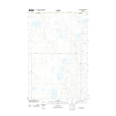
2013 Map of Mahnomen NE
USGS Topo · Published 2013About this map
Glacial lakes and wetlands define the landscape along the border of Polk and Mahnomen counties. This 2013 survey illustrates a rural terrain dominated by water bodies of various sizes, from the larger Beaulieu Lake and Vanose Lake to smaller basins like Frethem Lake and Blair Lake. The hydrology is anchored by Marsh Creek, which meanders through the northwest corner near Sand Hill Lake. Local transit is governed by a grid of county highways and township roads, including Co HWY-1 and 240th Ave. For those researching local history, the placement of the N Duane Cem and Duane Cem provides specific geographic anchors for the community's heritage in this sparsely populated region of Minnesota.
Find a feature on this map
22 named features on this map. Tap any name to fly to it.
Don’t see what you’re looking for? This feature index may not catch every label — zoom into the map to look around manually.
Map Details
Editions of this 2013 Mahnomen NE Map
This is the sole edition of this map. No revisions or reprints were ever made.
Other maps of this area

1919 · Fosston
USGS Topo · 1:62,500

1954 · Bemidji
USGS Topo · 1:250,000

1957 · Bemidji
USGS Topo · 1:250,000

1958 · Bemidji
USGS Topo · 1:250,000

1969 · North Twin Lake
USGS Topo · 1:24,000

1969 · Fosston East
USGS Topo · 1:24,000

1969 · Fosston West
USGS Topo · 1:24,000
1969 · Winger
USGS Topo · 1:24,000
1969 · Ebro NW
USGS Topo · 1:24,000
1969 · Bejou
USGS Topo · 1:24,000