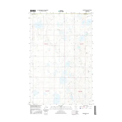
2016 Map of Mahnomen NE
USGS Topo · Published 2016About this map
Glacial depressions and water bodies dominate the landscape of the Polk and Mahnomen County border in this northern Minnesota survey. The terrain is defined by a dense network of lakes, ranging from the large Beaulieu Lake in the northwest to Vanose Lake and Aspinwall Lake in the south. These waters are often interconnected by seasonal wetlands and small drainage ways like Marsh Cr. Local history is anchored by the presence of North Duane Cem and Duane Cem in the eastern portion of the map, which serve as important touchstones for genealogical research in this rural township area. The survey shows a grid of county roads, such as Co ST Aid HWY 2 and Co RD 1, which navigate between the numerous lakes and provide access to the agricultural lands scattered throughout the lake-dotted prairie.
Find a feature on this map
33 named features on this map. Tap any name to fly to it.
Don’t see what you’re looking for? This feature index may not catch every label — zoom into the map to look around manually.
Map Details
Editions of this 2016 Mahnomen NE Map
This is the sole edition of this map. No revisions or reprints were ever made.
Other maps of this area

1919 · Fosston
USGS Topo · 1:62,500

1954 · Bemidji
USGS Topo · 1:250,000

1957 · Bemidji
USGS Topo · 1:250,000

1958 · Bemidji
USGS Topo · 1:250,000

1969 · North Twin Lake
USGS Topo · 1:24,000

1969 · Fosston East
USGS Topo · 1:24,000

1969 · Fosston West
USGS Topo · 1:24,000
1969 · Winger
USGS Topo · 1:24,000
1969 · Ebro NW
USGS Topo · 1:24,000
1969 · Bejou
USGS Topo · 1:24,000