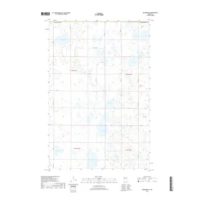
2019 Map of Mahnomen NE
USGS Topo · Published 2019About this map
Beaulieu Lake and a dense network of glacial wetlands define this section of the Minnesota landscape along the border of Mahnomen County. The area is characterized by an intricate water system, with Marsh Creek winding through the northern sections while larger bodies like Vanose Lake and Aspinwall Lake anchor the southern townships. The road network follows a strict section-line grid, including thoroughfares such as County State Aid Highway 2 and County Road 1, which facilitate travel between the scattered homesteads and water bodies.
Find a feature on this map
31 named features on this map. Tap any name to fly to it.
Don’t see what you’re looking for? This feature index may not catch every label — zoom into the map to look around manually.
Map Details
Editions of this 2019 Mahnomen NE Map
This is the sole edition of this map. No revisions or reprints were ever made.
Other maps of this area

1919 · Fosston
USGS Topo · 1:62,500

1954 · Bemidji
USGS Topo · 1:250,000

1957 · Bemidji
USGS Topo · 1:250,000

1958 · Bemidji
USGS Topo · 1:250,000

1969 · North Twin Lake
USGS Topo · 1:24,000

1969 · Fosston East
USGS Topo · 1:24,000

1969 · Fosston West
USGS Topo · 1:24,000
1969 · Winger
USGS Topo · 1:24,000
1969 · Ebro NW
USGS Topo · 1:24,000
1969 · Bejou
USGS Topo · 1:24,000