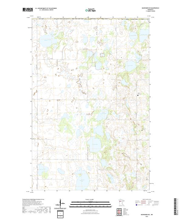
2022 Map of Mahnomen NE
USGS Topo · Published 2022About this map
Mahnomen County landscape is defined by a dense concentration of glacial basins and prairie potholes, with larger water bodies like Beaulieu Lake and Vanose Lake punctuating the township sections. The drainage network is anchored by Marsh Creek, which meanders through the northern reaches of the quadrangle. This area of Minnesota reflects a deeply rural character, where the grid of section-line roads such as 190th Ave and Co Rd 1 organizes the territory around small agricultural holdings and wetlands.
Find a feature on this map
27 named features on this map. Tap any name to fly to it.
Don’t see what you’re looking for? This feature index may not catch every label — zoom into the map to look around manually.
Map Details
Editions of this 2022 Mahnomen NE Map
This is the sole edition of this map. No revisions or reprints were ever made.
Other maps of this area

1919 · Fosston
USGS Topo · 1:62,500

1954 · Bemidji
USGS Topo · 1:250,000

1957 · Bemidji
USGS Topo · 1:250,000

1958 · Bemidji
USGS Topo · 1:250,000

1969 · North Twin Lake
USGS Topo · 1:24,000

1969 · Fosston East
USGS Topo · 1:24,000

1969 · Fosston West
USGS Topo · 1:24,000
1969 · Winger
USGS Topo · 1:24,000
1969 · Ebro NW
USGS Topo · 1:24,000
1969 · Bejou
USGS Topo · 1:24,000