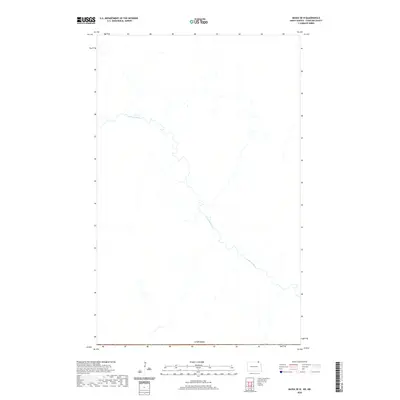
2020 Map of Maida OE N
USGS Topo · Published 2020About this map
The Pembina River meanders across this northern landscape, carving a winding path through the borderlands of North Dakota. This 2020 survey documents a largely undeveloped corridor where the river's hydrology defines the local geography. The map's southern edge is defined by the international boundary with Canada, illustrating the rural proximity between Cavalier County and its northern neighbor. The absence of major settlements or established road networks within this quadrangle suggests a remote, natural environment dominated by the river's course and the surrounding open terrain.
Find a feature on this map
2 named features on this map. Tap any name to fly to it.
Don’t see what you’re looking for? This feature index may not catch every label — zoom into the map to look around manually.
Map Details
Editions of this 2020 Maida OE N Map
This is the sole edition of this map. No revisions or reprints were ever made.
Other maps of this area

1953 · Devils Lake
USGS Topo · 1:250,000

1956 · Devils Lake
USGS Topo · 1:250,000

1967 · Maida
USGS Topo · 1:24,000

1969 · Olga NW
USGS Topo · 1:24,000

1970 · Mount Carmel
USGS Topo · 1:24,000

1985 · Langdon
USGS Topo · 1:100,000

2011 · Mount Carmel
USGS Topo · 1:24,000
2011 · Olga NW
USGS Topo · 1:24,000
2011 · Maida
USGS Topo · 1:24,000
2014 · Mount Carmel
USGS Topo · 1:24,000