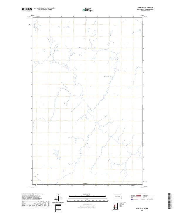
2024 Map of Maida OE N
USGS Topo · Published 2024About this map
The northern edge of Cavalier County meets the international border in this 2024 topographic study. Situated along the boundary with Canada, this rural landscape is defined by the headwaters and intricate drainages of north-flowing seasonal streams and creeks. The terrain is notably sparse of named settlements or infrastructure, providing a modern look at the undeveloped prairie and agricultural buffer zones that characterize this portion of the United States border. The map focuses on the natural topography and the legal demarcation of the international boundary, making it a clear reference for the exact position of the border line in this specific quadrangle.
Find a feature on this map
1 named feature on this map. Tap any name to fly to it.
Don’t see what you’re looking for? This feature index may not catch every label — zoom into the map to look around manually.
Map Details
Editions of this 2024 Maida OE N Map
This is the sole edition of this map. No revisions or reprints were ever made.
Other maps of this area

1953 · Devils Lake
USGS Topo · 1:250,000

1956 · Devils Lake
USGS Topo · 1:250,000

1967 · Maida
USGS Topo · 1:24,000

1969 · Olga NW
USGS Topo · 1:24,000

1970 · Mount Carmel
USGS Topo · 1:24,000

1985 · Langdon
USGS Topo · 1:100,000

2011 · Mount Carmel
USGS Topo · 1:24,000
2011 · Olga NW
USGS Topo · 1:24,000
2011 · Maida
USGS Topo · 1:24,000
2014 · Mount Carmel
USGS Topo · 1:24,000