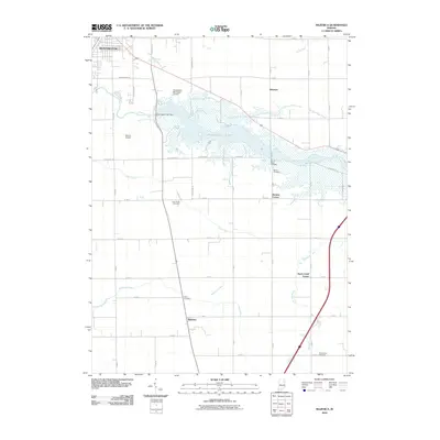
2010 Map of Majenica
USGS Topo · Published 2010About this map
Huntington Lake dominates the central landscape of this Huntington County quadrangle, formed by the Huntington Lake Dam across the Wabash River. The surrounding terrain is defined by a systematic grid of county roads and numerous drainage ditches like Fahl Ditch and Elkenberry Ditch, which manage the water levels of the surrounding agricultural lands. Small rural communities such as Majenica, Rock Creek Center, and Simpson serve as local anchors for the farming population.
Find a feature on this map
57 named features on this map. Tap any name to fly to it.
Don’t see what you’re looking for? This feature index may not catch every label — zoom into the map to look around manually.
Map Details
Editions of this 2010 Majenica Map
This is the sole edition of this map. No revisions or reprints were ever made.
Other maps of this area

1950 · Andrews
USGS Topo · 1:24,000

1950 · Warren
USGS Topo · 1:24,000

1950 · Mount Etna
USGS Topo · 1:24,000

1951 · Mount Etna
USGS Topo · 1:24,000

1951 · Andrews
USGS Topo · 1:24,000

1952 · Warren
USGS Topo · 1:24,000

1952 · Majenica
USGS Topo · 1:24,000

1953 · Muncie
USGS Topo · 1:250,000

1955 · Markle
USGS Topo · 1:24,000

1955 · Bippus
USGS Topo · 1:24,000