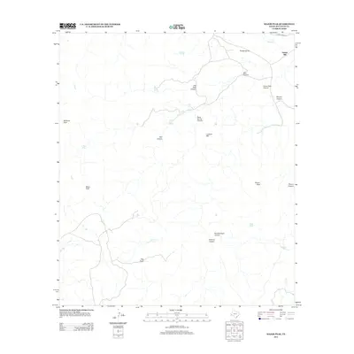
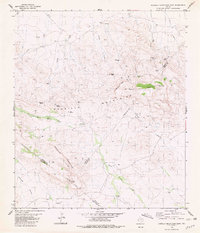
2012 Map of Major Peak
USGS Topo · Published 2012About this map
Saltlick Mill stands near the northern edge of this high-desert landscape in Jeff Davis County, marking a point of industry along Limpia Creek Rd. The topography is defined by a series of prominent summits and drainage basins, including Major Peak and Rincon Peak. Water management in this arid environment is evident through several named infrastructure points like El Toro Tank, Blas Tank, and Gabriel Tank, which likely supported ranching operations in the early 21st century. High points such as Lookout Mtn and Threemile Hill overlook a complex network of canyons, most notably Horse Thief Canyon and Bear Canyon. The map reveals a remote terrain where seasonal waterways like Limpia Cr and Indian Cr dictate the layout of the few established roads. Named landmarks such as Barbaras Point and Dog Point provide specific geographic anchors for local history and land use research.
Find a feature on this map
26 named features on this map. Tap any name to fly to it.
Don’t see what you’re looking for? This feature index may not catch every label — zoom into the map to look around manually.
Map Details
Editions of this 2012 Major Peak Map
This is the sole edition of this map. No revisions or reprints were ever made.
Other maps of this area

1894 · Fort Davis
USGS Topo · 1:125,000

1897 · Fort Davis
USGS Topo · 1:125,000

1954 · Fort Stockton
USGS Topo · 1:250,000

1958 · Fort Stockton
USGS Topo · 1:250,000

1972 · Swayback Mountain
USGS Topo · 1:24,000
1972 · Big Aguja Mountain
USGS Topo · 1:24,000
1972 · Fort Davis SE
USGS Topo · 1:24,000

1973 · Fort Stockton
USGS Topo · 1:250,000
1980 · Henderson Mesa
USGS Topo · 1:24,000
1980 · Barrilla Mountains East
USGS Topo · 1:24,000