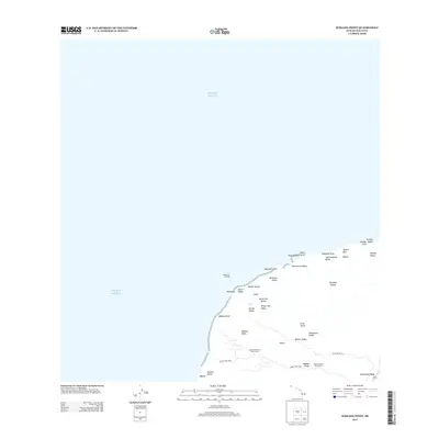
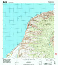
2013 Map of Makaha Point
USGS Topo · Published 2013About this map
Nāpali's dramatic coastline on the island of Kaua'i defines this coastal survey, where deep drainage valleys meet the Pacific Ocean. The landscape is characterized by a series of significant canyons including Nu'alolo Valley, Miloli'i Valley, and Mākaha Valley, each separated by prominent ridges such as Miloli'i Ridge and Mākaha Ridge. Public access and recreation are centered within Kokee State Park, which includes the Pine Forest Drive Picnic Area and Kāki'oke'oke'o Picnic Area. Along the shoreline, historical points of interest such as Keawanui Landing and Keawanui contrast with natural landmarks like the Honopu Arch and Queens Bath. The map reveals the intricate network of watercourses, including the Paaiki Falls, which feed into the rugged coast at locations like Nualolo Kai Beach and Miloli'i Beach. The interior is marked by high ridgelines like Kaunuohua Ridge, indicating the steep elevation changes characteristic of this region of Hawaii.
Find a feature on this map
37 named features on this map. Tap any name to fly to it.
Don’t see what you’re looking for? This feature index may not catch every label — zoom into the map to look around manually.
Map Details
Editions of this 2013 Makaha Point Map
This is the sole edition of this map. No revisions or reprints were ever made.
Other maps of this area

1954 · Kauai
USGS Topo · 1:250,000

1965 · Waimea Canyon
USGS Topo · 1:24,000

1965 · Haena
USGS Topo · 1:24,000

1965 · Makaha Point
USGS Topo · 1:24,000

1967 · Kauai
USGS Topo · 1:250,000

1970 · Kauai
USGS Topo · 1:250,000
1983 · Haena
USGS Topo · 1:24,000
1983 · Makaha Point
USGS Topo · 1:24,000
1983 · Waimea Canyon
USGS Topo · 1:24,000
1991 · Makaha Point
USGS Topo · 1:24,000