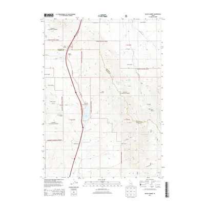
2013 Map of Malad Summit
USGS Topo · Published 2013About this map
Malad Summit marks the high point of this corridor between the Bannock and Oneida County line in southern Idaho. The landscape is defined by the extensive reaches of the Caribou National Forest, where steep canyons like Evans Canyon and Toms Canyon descend toward the valley floor. Water management and recreation are central to the area's character, centered on the Devil Creek Reservoir and its associated Public Fishing Area.
Find a feature on this map
51 named features on this map. Tap any name to fly to it.
Don’t see what you’re looking for? This feature index may not catch every label — zoom into the map to look around manually.
Map Details
Editions of this 2013 Malad Summit Map
This is the sole edition of this map. No revisions or reprints were ever made.
Other maps of this area

1954 · Pocatello
USGS Topo · 1:250,000

1958 · Pocatello
USGS Topo · 1:250,000

1968 · Malad Summit
USGS Topo · 1:24,000

1968 · Oxford
USGS Topo · 1:24,000

1968 · Malad City West
USGS Topo · 1:24,000

1968 · Downey West
USGS Topo · 1:24,000

1968 · Malad City East
USGS Topo · 1:24,000

1968 · Wakley Peak
USGS Topo · 1:24,000

1968 · Clifton
USGS Topo · 1:24,000
1968 · Downey East
USGS Topo · 1:24,000