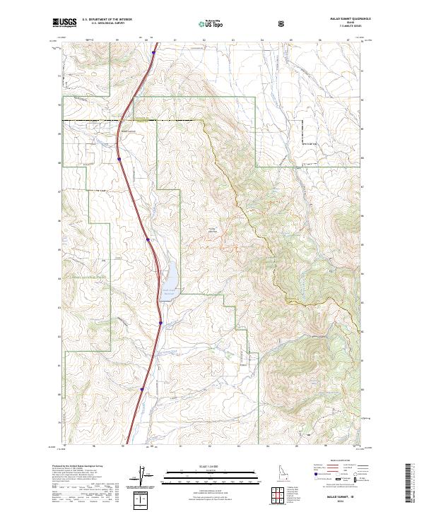
2024 Map of Malad Summit
USGS Topo · Published 2024About this map
Malad Summit stands as a prominent geographic divide in this modern 2024 landscape on the border of Bannock and Oneida counties. The central focus of the hydrological landscape is the Devil Creek Reservoir, which captures flows from Devil Creek and Campbell Creek before they move south. This area is characterized by a high-elevation network of canyons and draws, including North Canyon and Evans Canyon, which cut through the western slopes.
Find a feature on this map
51 named features on this map. Tap any name to fly to it.
Don’t see what you’re looking for? This feature index may not catch every label — zoom into the map to look around manually.
Map Details
Editions of this 2024 Malad Summit Map
This is the sole edition of this map. No revisions or reprints were ever made.
Other maps of this area

1954 · Pocatello
USGS Topo · 1:250,000

1958 · Pocatello
USGS Topo · 1:250,000

1968 · Malad Summit
USGS Topo · 1:24,000

1968 · Oxford
USGS Topo · 1:24,000

1968 · Malad City West
USGS Topo · 1:24,000

1968 · Downey West
USGS Topo · 1:24,000

1968 · Malad City East
USGS Topo · 1:24,000

1968 · Wakley Peak
USGS Topo · 1:24,000

1968 · Clifton
USGS Topo · 1:24,000
1968 · Downey East
USGS Topo · 1:24,000