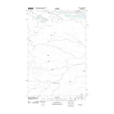
2011 Map of Malaga
USGS Topo · Published 2011About this map
The Columbia River defines the northern edge of this landscape, where the settlements of Malaga and Rock Island sit along the riverbanks. This 2011 survey captures the transition from these riverfront communities to the deeply incised canyon country to the south. Small water bodies like Lake Cortez, Putters Lake, and Meadow Lake are scattered near the river, often regulated by infrastructure such as the Three Lakes Reservoir Dam and Meadow Lake Dam.
Find a feature on this map
50 named features on this map. Tap any name to fly to it.
Don’t see what you’re looking for? This feature index may not catch every label — zoom into the map to look around manually.
Map Details
Editions of this 2011 Malaga Map
This is the sole edition of this map. No revisions or reprints were ever made.
Other maps of this area

1912 · Malaga
USGS Topo · 1:48,000

1913 · Wenatchee
USGS Topo · 1:62,500

1914 · Malaga
USGS Topo · 1:62,500

1915 · Wenatchee
USGS Topo · 1:62,500

1920 · Colockum Pass
USGS Topo · 1:125,000

1922 · Colockum Pass
USGS Topo · 1:125,000

1957 · Wenatchee
USGS Topo · 1:250,000
1966 · Malaga NE
USGS Topo · 1:24,000

1966 · Rock Island
USGS Topo · 1:24,000

1966 · Wenatchee
USGS Topo · 1:24,000