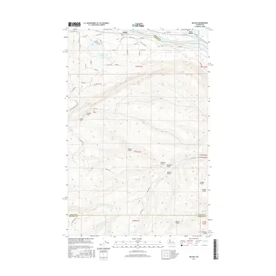
2017 Map of Malaga
USGS Topo · Published 2017About this map
The Columbia River defines the northern reaches of this territory, where the settlements of Malaga and Rock Island stand along its banks. The terrain south of the river rises sharply into a complex network of named drainages and high points, including Nickles Canyon, Kingsbury Canyon, and the prominent Jumpoff Ridge. This area shows a transition from the riparian residential developments near Lake Cortez to the more isolated upland canyons of the south.
Find a feature on this map
61 named features on this map. Tap any name to fly to it.
Don’t see what you’re looking for? This feature index may not catch every label — zoom into the map to look around manually.
Map Details
Editions of this 2017 Malaga Map
This is the sole edition of this map. No revisions or reprints were ever made.
Other maps of this area

1912 · Malaga
USGS Topo · 1:48,000

1913 · Wenatchee
USGS Topo · 1:62,500

1914 · Malaga
USGS Topo · 1:62,500

1915 · Wenatchee
USGS Topo · 1:62,500

1920 · Colockum Pass
USGS Topo · 1:125,000

1922 · Colockum Pass
USGS Topo · 1:125,000

1957 · Wenatchee
USGS Topo · 1:250,000
1966 · Malaga NE
USGS Topo · 1:24,000

1966 · Rock Island
USGS Topo · 1:24,000

1966 · Wenatchee
USGS Topo · 1:24,000