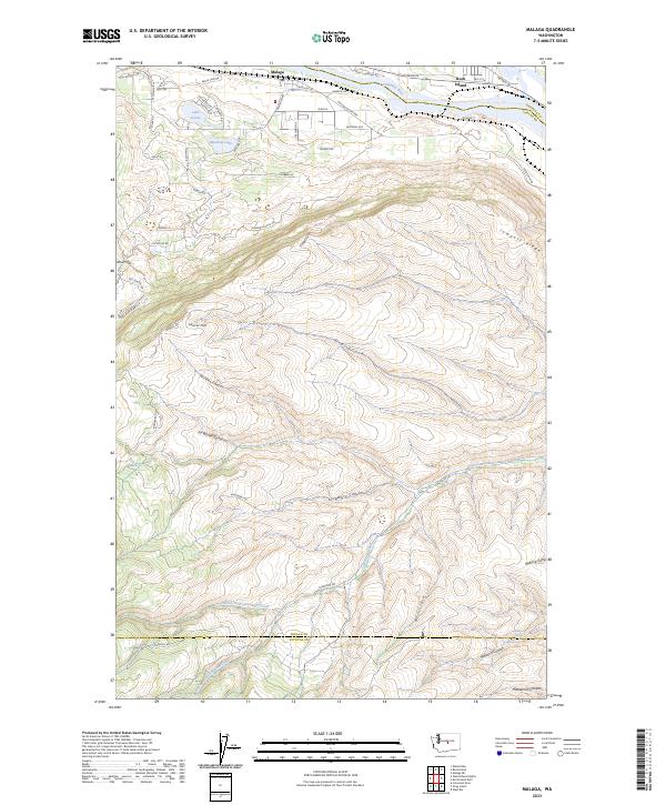
2023 Map of Malaga
USGS Topo · Published 2023About this map
Malaga sits on the southern bank of the Columbia River, serving as the primary settlement in this corner of Chelan County. The landscape is defined by the dramatic ascent from the river valley up toward Jumpoff Ridge and the Colockum Game Range to the south. Residential developments are clustered near the river, featuring private water bodies such as Lake Cortez and Meadow Lake, which contrast with the arid, deeply incised canyons that dominate the higher elevations.
Find a feature on this map
65 named features on this map. Tap any name to fly to it.
Don’t see what you’re looking for? This feature index may not catch every label — zoom into the map to look around manually.
Map Details
Editions of this 2023 Malaga Map
This is the sole edition of this map. No revisions or reprints were ever made.
Other maps of this area

1912 · Malaga
USGS Topo · 1:48,000

1913 · Wenatchee
USGS Topo · 1:62,500

1914 · Malaga
USGS Topo · 1:62,500

1915 · Wenatchee
USGS Topo · 1:62,500

1920 · Colockum Pass
USGS Topo · 1:125,000

1922 · Colockum Pass
USGS Topo · 1:125,000

1957 · Wenatchee
USGS Topo · 1:250,000
1966 · Malaga NE
USGS Topo · 1:24,000

1966 · Rock Island
USGS Topo · 1:24,000

1966 · Wenatchee
USGS Topo · 1:24,000