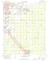
1964 Map of Malaga
USGS Topo · Published 1974About this map
The southeastern edge of Fresno and its surrounding agricultural valley appear here in a period of significant suburban expansion. Urban growth, highlighted by 1972 revisions, pushes toward Sunnyside and Goldleaf, while older settlements like Malaga and Calwa remain defined by their proximity to the heavy rail corridors of the Southern Pacific and the Atchison Topeka and Santa Fe. The landscape is a complex grid of irrigation and transport, where the Central Canal and American Canal weave between orchards and vineyards.
Find a feature on this map
65 named features on this map. Tap any name to fly to it.
Don’t see what you’re looking for? This feature index may not catch every label — zoom into the map to look around manually.
Map Details
Editions of this 1964 Malaga Map
3 editions found
Other maps of this area

1921 · Bullard
USGS Topo · 1:31,680

1922 · Round Mountain
USGS Topo · 1:31,680

1923 · Malaga
USGS Topo · 1:31,680

1923 · Fresno
USGS Topo · 1:31,680

1923 · Clovis
USGS Topo · 1:31,680

1923 · Sanger
USGS Topo · 1:31,680

1923 · Bullard
USGS Topo · 1:31,680

1924 · Selma
USGS Topo · 1:31,680

1924 · Conejo
USGS Topo · 1:31,680

1925 · Caruthers
USGS Topo · 1:31,680