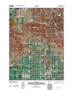
2011 Map of Malin
USGS Topo · Published 2011About this map
The town of Malin serves as the focal point of this Klamath County landscape, which is defined by an extensive network of irrigation infrastructure and rural ranching operations. The sophisticated water management system, comprising the V Canal, T Canal, Low Line Canal, and J Canal, illustrates the heavy reliance on engineered water sources for the region's agricultural success. Nearby landmarks like Seven Springs Ranch and the Malin Post Office anchor the community, while the Malin Airstrip indicates the importance of aerial access in this remote portion of Oregon. Terrain features such as Buck Butte, Sand Hollow, and Turkey Hill rise above the grid of farm roads. Genealogists will find the locations of Bedfield Cemetery and Malin Cemetery valuable for local family history research, alongside smaller water features including Buck-Butte Reservoir and Simms Dam.
Find a feature on this map
46 named features on this map. Tap any name to fly to it.
Don’t see what you’re looking for? This feature index may not catch every label — zoom into the map to look around manually.
Map Details
Editions of this 2011 Malin Map
This is the sole edition of this map. No revisions or reprints were ever made.
Other maps of this area

1886 · Modoc Lava Bed
USGS Topo · 1:250,000

1889 · Klamath
USGS Topo · 1:250,000

1892 · Modoc Lava-Bed
USGS Topo · 1:250,000

1894 · Klamath
USGS Topo · 1:250,000

1950 · Mt. Dome
USGS Topo · 1:62,500

1951 · Tulelake
USGS Topo · 1:62,500

1954 · Alturas
USGS Topo · 1:250,000

1955 · Klamath Falls
USGS Topo · 1:250,000

1957 · Merrill
USGS Topo · 1:62,500

1957 · Malin
USGS Topo · 1:62,500