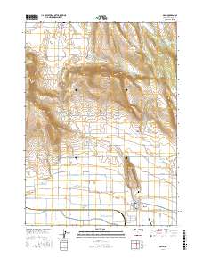
2017 Map of Malin
USGS Topo · Published 2017About this map
Malin sits at the southern edge of this landscape, a settlement defined by a dense grid of agricultural waterworks and reclamation projects. The intricate network of irrigation, including the V Canal, T Canal, and the prominent Low Line Canal, underscores the engineering required to transform the arid basins of Poe Valley and Tule Lake Valley into productive farmland. To the north, the terrain rises sharply toward Buck Butte and the volcanic uplands, where the Buck Butte Reservoir and John McFall Reservoir provide critical water storage. Family names and early rural infrastructure appear throughout the area, from the Bedfield Cem in the north to the Malin Cem and the Malin Airport near the town center. Local history is etched into the road names like Jelinek Rd and Micka Rd, reflecting the heritage of the homesteaders who settled this part of Klamath County along the Old Malin Hwy.
Find a feature on this map
48 named features on this map. Tap any name to fly to it.
Don’t see what you’re looking for? This feature index may not catch every label — zoom into the map to look around manually.
Map Details
Editions of this 2017 Malin Map
This is the sole edition of this map. No revisions or reprints were ever made.
Other maps of this area

1886 · Modoc Lava Bed
USGS Topo · 1:250,000

1889 · Klamath
USGS Topo · 1:250,000

1892 · Modoc Lava-Bed
USGS Topo · 1:250,000

1894 · Klamath
USGS Topo · 1:250,000

1950 · Mt. Dome
USGS Topo · 1:62,500

1951 · Tulelake
USGS Topo · 1:62,500

1954 · Alturas
USGS Topo · 1:250,000

1955 · Klamath Falls
USGS Topo · 1:250,000

1957 · Merrill
USGS Topo · 1:62,500

1957 · Malin
USGS Topo · 1:62,500