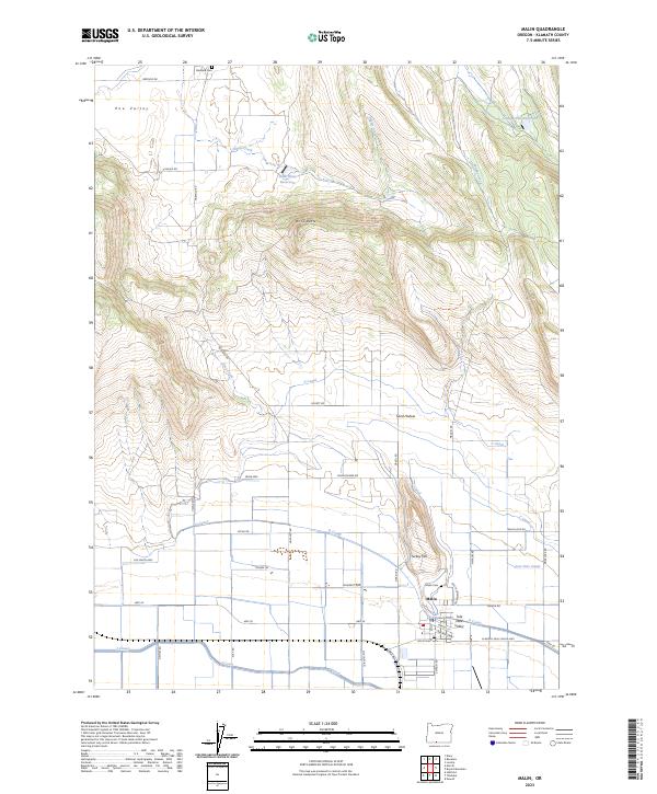
2023 Map of Malin
USGS Topo · Published 2023About this map
The town of Malin serves as the hub of this agricultural landscape in the Tule Lake Valley, where a complex network of irrigation infrastructure supports the region's farms. The map illustrates a disciplined grid of rural roads and canals, including the Low Line Canal, V Canal, and T Canal, which distribute water across the valley floor. These man-made waterways contrast with the natural drainage of Simms Creek and Wright Creek descending from the higher elevations of Buck Butte.
Find a feature on this map
51 named features on this map. Tap any name to fly to it.
Don’t see what you’re looking for? This feature index may not catch every label — zoom into the map to look around manually.
Map Details
Editions of this 2023 Malin Map
This is the sole edition of this map. No revisions or reprints were ever made.
Other maps of this area

1886 · Modoc Lava Bed
USGS Topo · 1:250,000

1889 · Klamath
USGS Topo · 1:250,000

1892 · Modoc Lava-Bed
USGS Topo · 1:250,000

1894 · Klamath
USGS Topo · 1:250,000

1950 · Mt. Dome
USGS Topo · 1:62,500

1951 · Tulelake
USGS Topo · 1:62,500

1954 · Alturas
USGS Topo · 1:250,000

1955 · Klamath Falls
USGS Topo · 1:250,000

1957 · Merrill
USGS Topo · 1:62,500

1957 · Malin
USGS Topo · 1:62,500