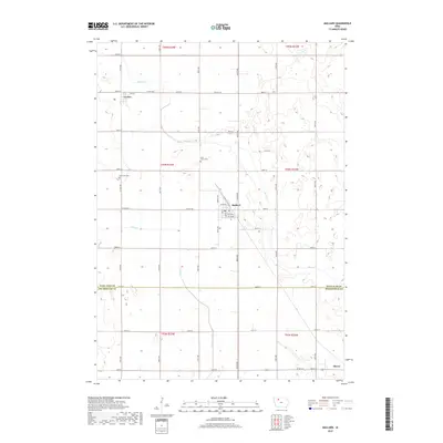
2018 Map of Mallard
USGS Topo · Published 2018About this map
The town of Mallard sits at the heart of this North Central Iowa landscape, situated along the border of Palo Alto and Pocahontas counties. This agricultural region is defined by a dense grid of section roads and the winding paths of Beaver Cr and Pilot Cr, which drain the surrounding prairie lands. To the northwest, the small settlement of Curlew is located near Co Hwy N38, while the community of Plover anchors the southeastern corner of the map. Genealogical interest is centered on several rural burial grounds, including Saint Mary's Cem and Rush Lake Cem, which reflect the area's settlement history and community ties. The layout of the township lines, such as t94n r33w, illustrates the systematic land division that has shaped this part of the Midwest for generations.
Find a feature on this map
46 named features on this map. Tap any name to fly to it.
Don’t see what you’re looking for? This feature index may not catch every label — zoom into the map to look around manually.
Map Details
Editions of this 2018 Mallard Map
This is the sole edition of this map. No revisions or reprints were ever made.
Other maps of this area

1954 · Fairmont
USGS Topo · 1:250,000

1954 · Fort Dodge
USGS Topo · 1:250,000

1957 · Fort Dodge
USGS Topo · 1:250,000

1958 · Fort Dodge
USGS Topo · 1:250,000

1958 · Fairmont
USGS Topo · 1:250,000

1971 · Rush Lake East
USGS Topo · 1:24,000

1971 · Laurens
USGS Topo · 1:24,000

1972 · Ayrshire
USGS Topo · 1:24,000

1980 · Rolfe
USGS Topo · 1:24,000

1980 · Havelock
USGS Topo · 1:24,000