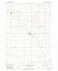
1980 Map of Mallard
USGS Topo · Published 1980About this map
The agricultural landscape of Northwest Iowa is meticulously documented in this 1980 survey, where the grid of rural section lines is interrupted by the diagonal path of the Chicago and North Western railroad. The town of Mallard serves as a central hub, flanked by the smaller settlements of Curlew to the northwest and Plover at the southern edge. These communities developed as vital rail stops for the transport of grain and livestock across the prairie. Local history is anchored by sites like St Marys Cem and Rush Lake Cem, which provide significant points of interest for genealogists tracing early families in the region. The map also captures the natural drainage patterns of the plains, primarily through the winding courses of Beaver Creek and Pilot Creek, which cut through the townships of Rush Lake and Ellington.
Find a feature on this map
18 named features on this map. Tap any name to fly to it.
Don’t see what you’re looking for? This feature index may not catch every label — zoom into the map to look around manually.
Map Details
Editions of this 1980 Mallard Map
This is the sole edition of this map. No revisions or reprints were ever made.
Other maps of this area

1954 · Fairmont
USGS Topo · 1:250,000

1954 · Fort Dodge
USGS Topo · 1:250,000

1957 · Fort Dodge
USGS Topo · 1:250,000

1958 · Fort Dodge
USGS Topo · 1:250,000

1958 · Fairmont
USGS Topo · 1:250,000

1971 · Rush Lake East
USGS Topo · 1:24,000

1971 · Laurens
USGS Topo · 1:24,000

1972 · Ayrshire
USGS Topo · 1:24,000

1980 · Rolfe
USGS Topo · 1:24,000

1980 · Havelock
USGS Topo · 1:24,000