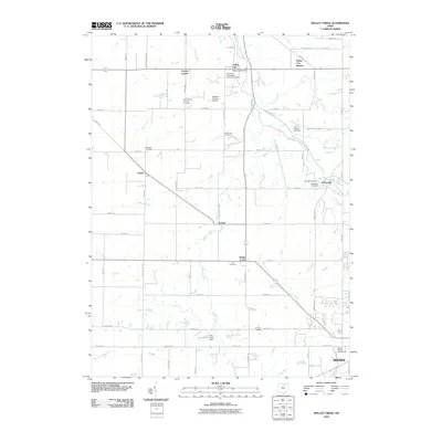
2010 Map of Mallet Creek
USGS Topo · Published 2010About this map
Valley City and the surrounding rural landscapes of Medina County are defined by a network of creeks and small crossroads settlements. This 2010 survey details a region where agriculture and local history intersect, evidenced by the numerous cemeteries such as Saint Pauls Evangelical Lutheran Cemetery and Greenhoe Cemetery that dot the countryside. The northern edge of Medina is visible at the bottom of the sheet, featuring the Medina County Fairgrounds, while smaller communities like Lester, Erhart, and Abbeyville serve as local hubs for the surrounding farmsteads. The drainage of the West Branch Rocky River and Mallet Creek dictates the topography, winding between established road grids like Abbeyville Rd and Station Rd. Notable local landmarks include the Valley City Post Office and the Boy Scout Camp situated near the Abbeyville Cemetery.
Find a feature on this map
63 named features on this map. Tap any name to fly to it.
Don’t see what you’re looking for? This feature index may not catch every label — zoom into the map to look around manually.
Map Details
Editions of this 2010 Mallet Creek Map
This is the sole edition of this map. No revisions or reprints were ever made.
Other maps of this area

1901 · Oberlin
USGS Topo · 1:62,500

1902 · Berea
USGS Topo · 1:62,500

1903 · Oberlin
USGS Topo · 1:62,500

1904 · Berea
USGS Topo · 1:62,500

1904 · Medina
USGS Topo · 1:62,500

1904 · Wellington
USGS Topo · 1:62,500

1906 · Medina
USGS Topo · 1:62,500

1906 · Wellington
USGS Topo · 1:62,500

1950 · Cleveland
USGS Topo · 1:250,000

1953 · West View
USGS Topo · 1:24,000