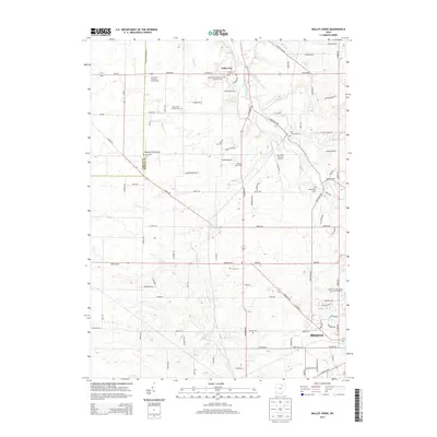
2013 Map of Mallet Creek
USGS Topo · Published 2013About this map
Medina anchor the southern reaches of this landscape, where the growing city grid meets the agricultural heritage of the West Branch Rocky River valley. This 2013 survey illustrates the dense network of rural roads and homesteads across the Lorain Co and Medina Co border, punctuated by a significant concentration of burial sites and family farmsteads. Genealogical interest is particularly high here, with numerous landmarks such as Saint Pauls Evangelical Lutheran Cem, York Cem, and Greenhoe Cem serving as anchors for the local community's history.
Find a feature on this map
102 named features on this map. Tap any name to fly to it.
Don’t see what you’re looking for? This feature index may not catch every label — zoom into the map to look around manually.
Map Details
Editions of this 2013 Mallet Creek Map
This is the sole edition of this map. No revisions or reprints were ever made.
Other maps of this area

1901 · Oberlin
USGS Topo · 1:62,500

1902 · Berea
USGS Topo · 1:62,500

1903 · Oberlin
USGS Topo · 1:62,500

1904 · Berea
USGS Topo · 1:62,500

1904 · Medina
USGS Topo · 1:62,500

1904 · Wellington
USGS Topo · 1:62,500

1906 · Medina
USGS Topo · 1:62,500

1906 · Wellington
USGS Topo · 1:62,500

1950 · Cleveland
USGS Topo · 1:250,000

1953 · West View
USGS Topo · 1:24,000