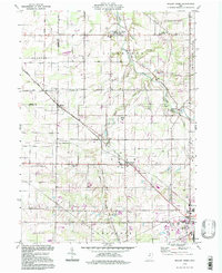
1994 Map of Mallet Creek
USGS Topo · Published 1997About this map
Valley City and the crossing of the Branch Rocky River define this rural landscape in northeastern Ohio, where the agricultural character of York and Liverpool townships remained largely intact through the late twentieth century. The map documents a network of small settlements and crossroad hamlets like Erhart, Lester, and Mallet Creek, many of which grew around early transportation routes like the Baltimore and Ohio railroad. Local genealogy and community life are well-represented by several historic congregations and burial grounds, including St Pauls Ch, St Martins Ch, and the Rest Acre Cem.
Find a feature on this map
50 named features on this map. Tap any name to fly to it.
Don’t see what you’re looking for? This feature index may not catch every label — zoom into the map to look around manually.
Map Details
Editions of this 1994 Mallet Creek Map
This is the sole edition of this map. No revisions or reprints were ever made.
Other maps of this area

1901 · Oberlin
USGS Topo · 1:62,500

1902 · Berea
USGS Topo · 1:62,500

1903 · Oberlin
USGS Topo · 1:62,500

1904 · Berea
USGS Topo · 1:62,500

1904 · Medina
USGS Topo · 1:62,500

1904 · Wellington
USGS Topo · 1:62,500

1906 · Medina
USGS Topo · 1:62,500

1906 · Wellington
USGS Topo · 1:62,500

1950 · Cleveland
USGS Topo · 1:250,000

1953 · West View
USGS Topo · 1:24,000