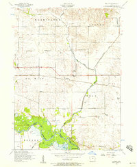
1953 Map of Malone
USGS Topo · Published 1957About this map
The Warsipinicon River meanders across the southern landscape of this mid-century quadrangle, marking the border near Princeton and Butler. This area of eastern Iowa is defined by a dense network of early rural educational centers, including Quinn School, Burke School, and Gove School in the north, while Hatfield School and Liberty School serve the central townships. The small settlement of Malone sits at a critical junction where the Chicago and Northwestern railroad crosses Cherry Creek. Local family history is preserved in several dedicated grounds like the Pehlam Cemetery and the Hill Dannatt Bowers Cemetery. The drainage patterns of Brophy Creek and Ames Creek reflect the undulating topography that shaped the early 20th-century farmstead layouts throughout Washington and De Witt townships.
Find a feature on this map
31 named features on this map. Tap any name to fly to it.
Don’t see what you’re looking for? This feature index may not catch every label — zoom into the map to look around manually.
Map Details
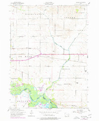
Editions of this 1953 Malone Map
2 editions found
Other maps of this area

1891 · DeWitt
USGS Topo · 1:62,500

1891 · Davenport
USGS Topo · 1:62,500

1892 · Goose Lake
USGS Topo · 1:62,500

1892 · Leclaire
USGS Topo · 1:62,500

1893 · Leclaire
USGS Topo · 1:62,500

1894 · Goose Lake
USGS Topo · 1:62,500

1894 · Davenport
USGS Topo · 1:62,500

1899 · Clinton
USGS Topo · 1:125,000

1901 · Rock Island
USGS Topo · 1:125,000

1910 · Rock Island
USGS Topo · 1:125,000